Tuesday, October 4
We got up early this morning, packed up and headed out of Yosemite. There was a snow storm watch for Yosemite at high elevations last night and the ranger told us we may not be able to leave the park via the Tioga Pass road which we were planning on taking. Thankfully the pass was open but at over 9000 feet we did see a beautifully snow covered forest, giving the park a new look on our way out.
Driving out of Yosemite
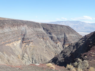
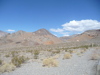
From what we had read about Death Valley and our own pre-conceived ideas, we weren’t expecting anything more than flat barren waste land. What a surprise! Death Valley is beautiful! Duh, valley ~ we knew it was a valley and therefore mountains but had no idea of their size and magnitude.
 |
| sharp drop offs |
Driving out of Yosemite
 |
| getting higher |
 |
| and then the winter wonderland |
Taking rt 395 south we drove about four hours to Death Valley.
From what we had read about Death Valley and our own pre-conceived ideas, we weren’t expecting anything more than flat barren waste land. What a surprise! Death Valley is beautiful! Duh, valley ~ we knew it was a valley and therefore mountains but had no idea of their size and magnitude.
 |
| Rainbow Canyon |
 |
| the sun was so bright it really drowns out the colors |
 |
| people at the lookout for Rainbow Canyon |
 | |
| Rainbow Canyon |
 |
| Father Crowley Vista ~ Padre to the Valley |

For us, this was basically a drive through experience. But we took short hikes to the Sand Dunes, Badwater and Zabriskie Point.

Sand Dunes: three things are needed to form sand dunes; sand, wind, and something to trap the wind.
In Death Valley the sand/dirt comes off the mountains on one side as the winds come in from the north and then Tucki Mountain keeps the sand trapped. Some of these dunes rise 100 ft over Mesquite Flat.

Badwater Basin is the lowest point in North America at 282 ft below sea level. A surveyor working in the area tried to lead his mule to water but the mule wouldn’t drink so he recorded ‘bad water’ in his journal. The name stuck. Appearing like a huge lake, the basin is a surreal landscape of salt flats. Looking up at the cliffs behind we saw a sign marking sea level high above our heads.
 |
| walk to the lake |
 |
| lake of salt |
This area has recesses so like the moon, astronauts have trained here.
Zabriskie Point is one of the parks most famous views. It is difficult to describe this multicolored maze of eroded ‘badlands’.
 |
| Zabriskie Point |
In this area of 'Badlands' Colemanite and Uluxite ~ better known as Borax ~ were mined using the famous 20 mule team.
One of the coolest roads was the single lane, one way drive through Artists Drive. This was a real roller coaster ride. Up, down and around. It was so tight that no vehicles larger than 25 feet were allowed.
The most unbelievable part was that after taking two pictures, our camera battery died. There was no way this area could be captured on camera (not on ours anyway). The color and size of these volcanic rock formations were amazing.
| took this one on my phone but you can't really see the beautiful colors |
The metropolis of Furnace Creek, consisting of 6 buildings is where the Visitor Center, General Store, Pub and such are located.


No comments:
Post a Comment